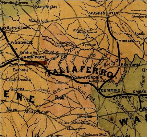
Northern Georgia and Western and Central South Carolina
Lindenkohl. H. Lindenkohl & Chas. G. Krebs, lith.
Lindenkohl, A.
CREATED/PUBLISHED
U.S. Coast Survey, A. D. Bache, Supdt., 1865
REPOSITORY
Library of Congress Geography and Map Division Washington, D.C.
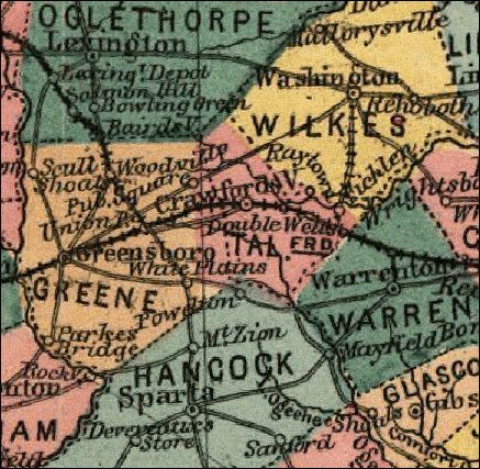
Indexed Railroad and County Map of Georgia
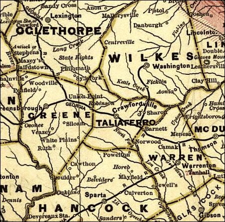
Cram, George Franklin, 1841-1928.
CREATED/PUBLISHED
Chicago, [1883]
REPOSITORY
Library of Congress Geography and Map Division Washington, D.C.
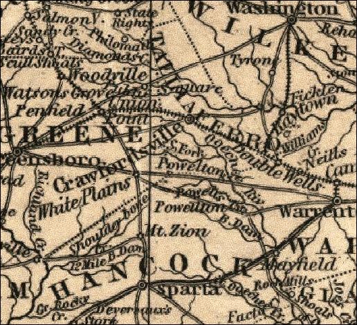
The Army Map of Georgia
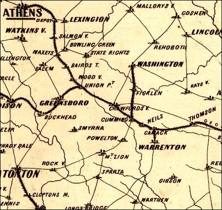
Louis Prang and Company.
CREATED/PUBLISHED
Boston, L. Prang & Co., c1864.
REPOSITORY
Library of Congress Geography and Map Division Washington, D.C
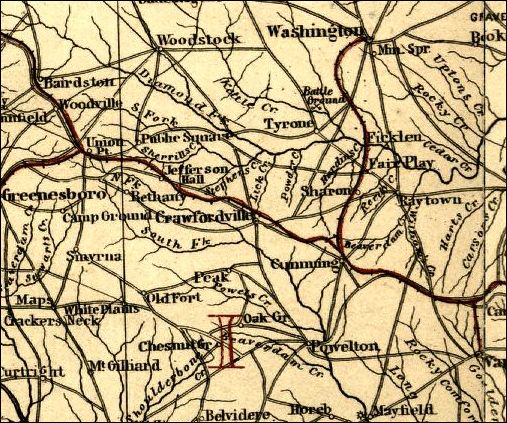
Lloyd's Topographical Map of Georgia From State Surveys Before the War
Showing Railways, Stations, Villages, Mills, &c.
Lloyd, James T.
CREATED/PUBLISHED
New York, J. T. Lloyd, 1864.
REPOSITORY
Library of Congress Geography and Map Division Washington, D.C.
Railway and CountyMap of the Southern States
Mendenhall, Edward.
CREATED/PUBLISHED
Cincinnati, E. Mendenhall, 1864.
REPOSITORY
Library of Congress Geography and Map Division Washington, D.C.
J. H. Colton's Topographical Map of North and South Carolina. A large portion
of Georgia & Part of Adjoining States
Colton, J. H. 1800-1893. (Joseph Hutchins),
CREATED/PUBLISHED
New York Printed by Lang & Laing 1861.
REPOSITORY
Library of Congress Geography and Map Division Washington, D.C.
Taliaferro Highway map
An excellent source for many archival maps of Taliaferro County is
the Historical
Atlas of Georgia Counties,
|